Published: 22 Jan 2025
Undertaking underground utility surveys is one of the truly vital services provided by the land survey profession.
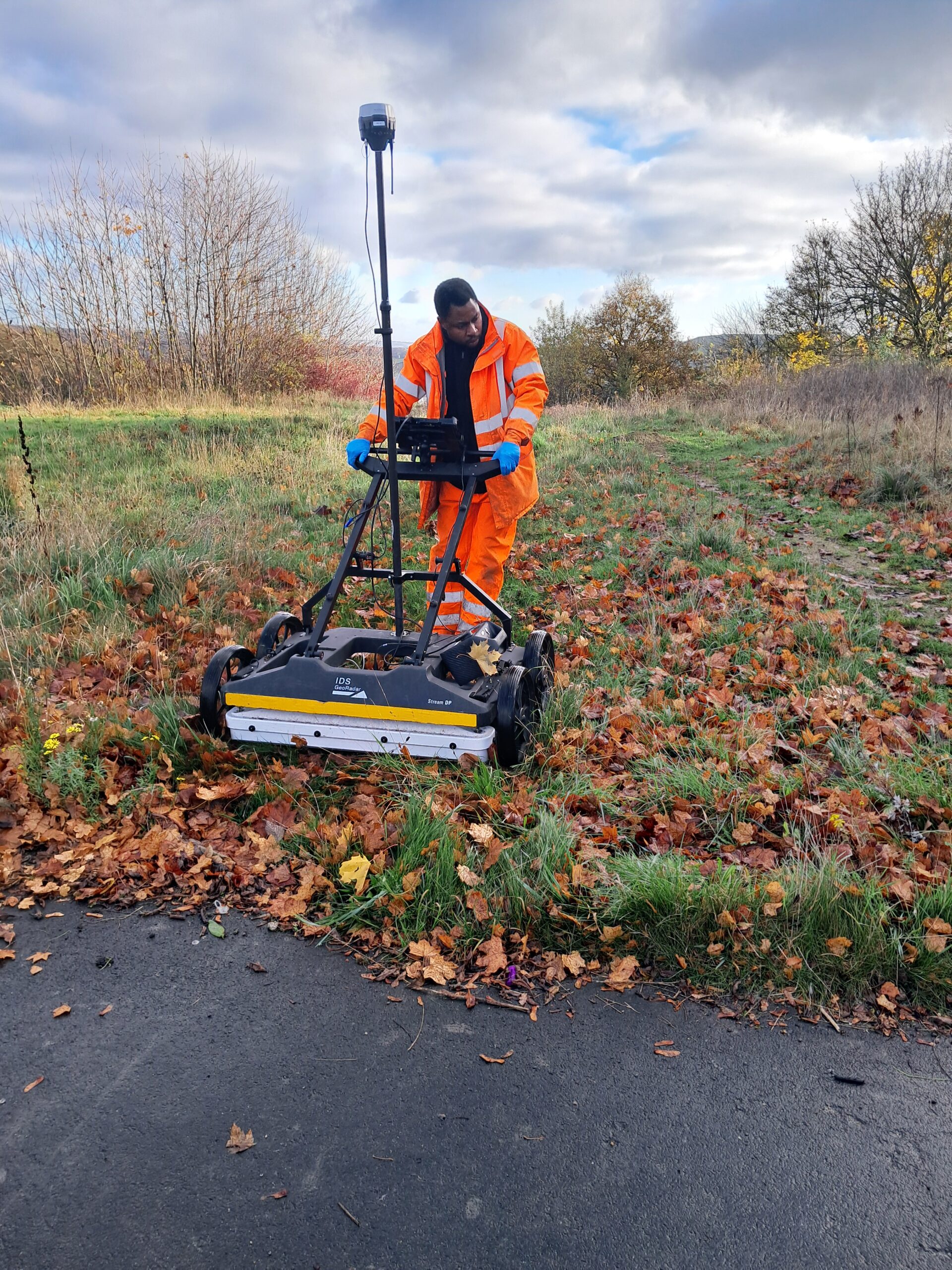
Before any construction can take place, an underground survey needs to be carried out so that the whereabouts of any utilities, such as gas, electric and water supply, or drainage services, can be identified. In addition, any other obstructions and potential hazards can also be located and mapped using Ground Penetrating Radar (GPR) or Electromagnetic Location.
Having an accurate picture of exactly what is under the ground reduces the chances of a service strike which can lead to costly delays and inconvenience at the very least, and danger to life in the worst case scenario.
NUAR: digital mapping of underground infrastructure in England, Wales and Northern Ireland
The importance of improving knowledge about underground infrastructure has been highlighted by the Geospatial Commission, which is currently building a digital map to show the recorded location of underground pipes and cables in England, Wales and Northern Ireland to improve efficiency and safety with regard to installation, maintenance, operation and repair of buried infrastructure. The scheme, named the National Underground Asset Register (NUAR) is scheduled to be fully operational by the end of 2025.
NUAR will provide secure access to data from over 600 public and private sector asset owners, including more than 600 gas, water, electric and telecomms companies and local government bodies. TSA welcomes this initiative which should improve public services and the safety of all those involved in construction projects.
However, it is important to recognise that this digitised record information will still be subject to the same inaccuracy and incompleteness that the paper records it is based on were affected by. It will still be safety critical to carry out utility surveys ahead of excavations and to provide reliable information for project planning and development.
Providing a means of highlighting inaccurate data within the NUAR platform will be an important feedback mechanism which will be able to ensure continuous improvement of the stored utility information.
NUAR recently announced that they are exploring ways of providing accredited utility survey companies access to the platform, with accreditation providing confidence to asset owners that the access they have and the observations they make concerning the location of buried services could be trusted.
PUMA: setting a benchmark and raising standards in underground surveying
Long motivated by the need to improve standards in underground surveys and ensure the highest levels of accuracy, TSA has set up PUMA, which is the first PAS128 Accreditation Scheme for utility surveying companies. The acronym PUMA stands for PAS128 Utility Mapping Accreditation and utility surveying companies that are TSA members can apply for the accreditation. The PUMA scheme is getting recognition at the highest levels.
The scheme, run by LRQA, aims to provide assurance to clients of the high quality of service and high level of accuracy in the data provided by a PUMA accredited company. In this way, accredited members have a means of demonstrating compliance with the PAS128 specification, and provide clients with confidence that the survey company they choose has the appropriate level of competence and employ qualified staff who understand the complexities of PAS128 surveys..
PUMA aims to provide:
- Clarity about different types of utility mapping services
- Consistency in how these services are carried out
- Accountability for the work undertaken
A guidance document and application form for PUMA can be found here. Find out how to become a TSA member here.

