Published: 11 Dec 2024
One of the more unusual surveys our members carry out are Bathymetric surveys. Otherwise known as Underwater surveys and Hydrographic surveys, these surveys are used in any area of open water, to ascertain depths and the underlying topography of the land below, such as a seabed or riverbed. Bathymetry is the study of underwater land masses. You may not know that the word bathymetry is from Ancient Greek – ‘bathús’ (meaning deep) and ‘métron’ (meaning measure).
Depth of knowledge
This type of survey is used to provide accurate data on what lies beneath the water’s surface and is ideal for surveying natural features such as lakes and rivers, meres, broads and other waterways. It can also be used for manmade features, such as harbours, boatyards, reservoirs, water treatment plants and canals.
A bathymetric survey accurately calculates the depth of the water body and measures the ground below the water and is effective up to a depth of 10 metres. The data can then be used to create a Digital Terrain Model (DTM) which can show the undulations and contours of the land below the water’s surface.
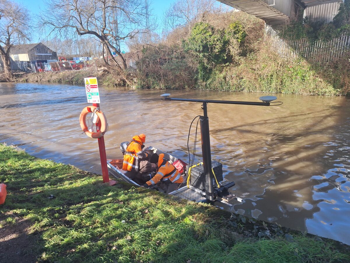
There are many uses for this type of survey. For example, if a river is to be traversed by a new road bridge. The survey is carried out using a piece of equipment called an hydrone. As the name suggests, this a type of remote-controlled drone, which is essentially a surveying boat. Like any water-borne craft, its use is weather dependent. The device is controlled by an operator from shore or on a boat. The hydrone is equipped with GPS and echo sounders, which can record set points and distances.
Making waves with bathymetric surveys
The first recorded evidence of water depth measurements was found in Ancient Egypt over 3,000 years ago. The historical origins of underwater surveys were closely related to sailing. A bathymetric or hydrographic survey required the use of lead lines – ropes or lines with depth markings which were weighted with lead to make one end sink. The reading on the line would provide the depth. This was a very laborious and time-consuming process, but the digitalisation of bathymetric surveys has considerably simplified and streamlined the gathering and assessing of data.
Nowadays, this type of survey can be used prior to activities such as installing underwater utility runs, siting structures such as platforms or drilling rigs, or before clean-up activities like dredging is carried out.
Sometimes bathymetric surveys will form part of a wider survey and can be used in conjunction with topographical surveys, to create a complete picture of a landscape and what it contains. All kinds of clients may require a bathymetric survey – the survey results can be used to measure features that affect a myriad of hydro-related activities, such as maritime navigation, marine construction, offshore wind farms, offshore oil exploration and drilling and other related industrial activities.

