Published: 26 Feb 2025
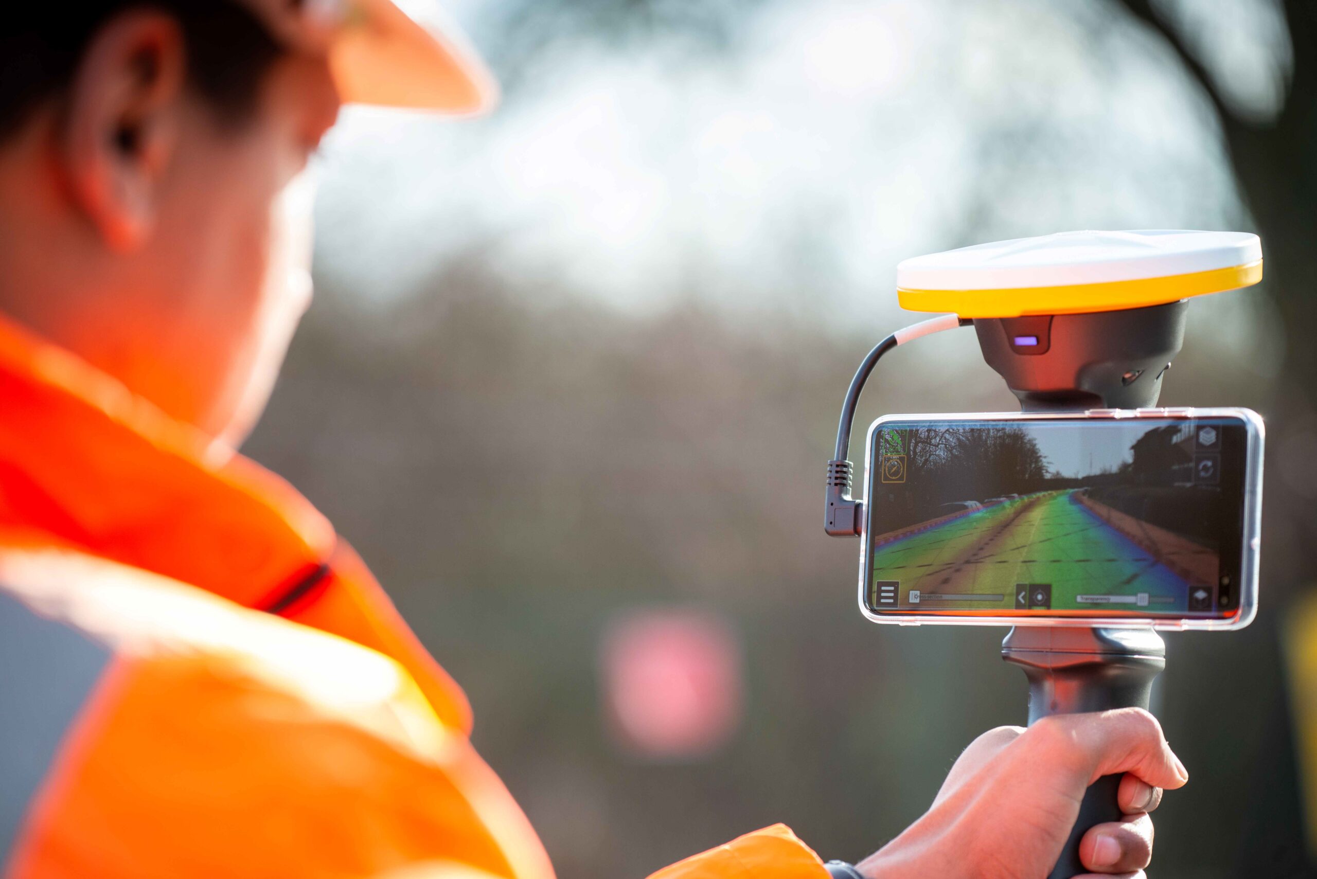
Our members carry out surveys in all kinds of different ways – overground, underground and from the air. One method we use to gather digital data is the Pedestrian Mobile Mapping System (MMS). This is a way of collecting geospatial data while walking. The data is collected using lightweight equipment that can be worn or carried by a surveyor, whilst the geospatial data around them is captured by various sensors, including laser scanning and photography. The data capture device can be handheld, or mounted on a backpack, for example, making it ideal for use in accessible areas.
Data capture on the move
This technology integrates active and passive sensors and intelligent algorithms to provide precise positions, to capture real-time geospatial data on the move. Prior to carrying out a Pedestrian MMS survey, it’s essential to plan out an optimum path that will collect the most data in the most efficient time. All outside factors and variables must be considered, including the range of the equipment’s sensors, the conditions for the Global Navigational Satellite System (GNSS) and the limitations of Simultaneous Localisation and Mapping (SLAM). Once the data is recorded through the Pedestrian MMS active and passive sensors, it is simultaneously time-stamped and linked to the survey route.
Visualising your surroundings
The main components of data capture equipment for a Pedestrian MMS include some or all of these sensors, both active and passive. Active sensors include Time of Flight Laser Scanners (Class 1) to provide LiDAR (Light Detection and Ranging) point clouds – these are dense data points that together create detailed visualisations. The sensors emit a laser electromagnetic pulse millions of times a second. When visualising the LiDAR point cloud based on the intensity values, they add a high level of extremely useful detail to the dataset. As long as the surface is within the range of the laser, the pulse of energy travels until it finds a surface and is bounced back to the sensor. The result is a coordinated 3D representation of the area and the dimensions captured during the survey.
Pedestrian mobile mapping systems vary in size, sensor type and accuracy. GNSS Receivers are utilised to track satellite signals to determine the position of the equipment. IMUs are electronic devices fitted with accelerometers and gyroscopes that report changes in speed and direction at a high rate. Drift suffered from accumulated errors is a disadvantage with these sensors. SLAM is an intelligent algorithm with the ability to localise the system in an unknown environment, while mapping its surrounding area. More recently, organisations are developing their own SLAM algorithms to merge and process the data provided by the IMUs and the sensors of an MMS. The time it takes to collect the data is its main limitation.
Walking the walk with Pedestrian Mobile Mapping
There are several benefits of carrying out a survey using Pedestrian Mobile Mapping. It allows flexibility for the operator during data capture and the ability to cover large areas in short periods of time. Productivity is increased, as data is recorded in a continuous cycle while the operator navigates the area. The processing stage back at the office is simplified too. Pedestrian MMS are small, light and versatile – therefore the technology can also be utilised to capture data on moving platforms such as cars, UAVs (unmanned aerial vehicles) or drones, quadbikes, segways, boats, cherry pickers and other mobile vehicles.
Another plus is that large areas of data can be captured with only one surveyor. This makes it a cost-effective way of creating 3D point clouds for visual representations of landscapes and infrastructure. Pedestrian mobile mapping has a relaxed accuracy compared to static survey techniques and is a less expensive alternative to more costly static survey techniques, providing accuracy is not a priority.
Pedestrian MMS can be used in a range of applications. These include Topographical surveys, As-built and Digital Documentation, Smart Cities and City Modelling, Volume calculations in large construction sites, and Mapping the unknown. For BIM and Asset Management, Pedestrian MMS fits perfectly in the process of capturing, creating and managing all the information about an asset throughout its lifetime. They can also be used in instances of public safety, event preparation, demonstrations and evacuation routes; disaster recovery for fast and flexible acquisition of critical damaged areas; and environment applications for monitoring geological features such as rivers, coastline erosion or landslides. Mobile Mapping can also create realistic VR environments for the gaming and the film industry, augmented reality and Digital Elevation Model generation.