Published: 30 Oct 2024
Accurately measured data has always been vital for a successful building project, especially at the initial design stage and then during construction too. Nowhere is this more essential than in the rail sector, where accuracy to a millimetre is absolutely paramount, whether undertaking routine maintenance, carrying out repairs or building new lines.
Rail surveying is very specialised and there are only a few firms in the UK offering expertise in this sector. Highly trained teams need a very specific set of skills and must abide by Network Rail standards to ensure the safety of everyone involved.
Rail survey work does not suit everyone, with the hours often being anti-social and also very high pressure. ‘Possession’, meaning time available for work to be carried out on railways, is strictly limited, as, of course, work can only take place when the trains are not running. Usually, possession occurs at night, and, as that’s when other tasks, such as essential maintenance, may be taking place too, surveying work has to be carried out quickly, with maximum efficiency, owing to the time pressure. A number of different teams are likely to be working in the same pressured ‘window’, so the ability to work collaboratively, as well as efficiently when under pressure is very important.
Technology has transformed the world of land survey
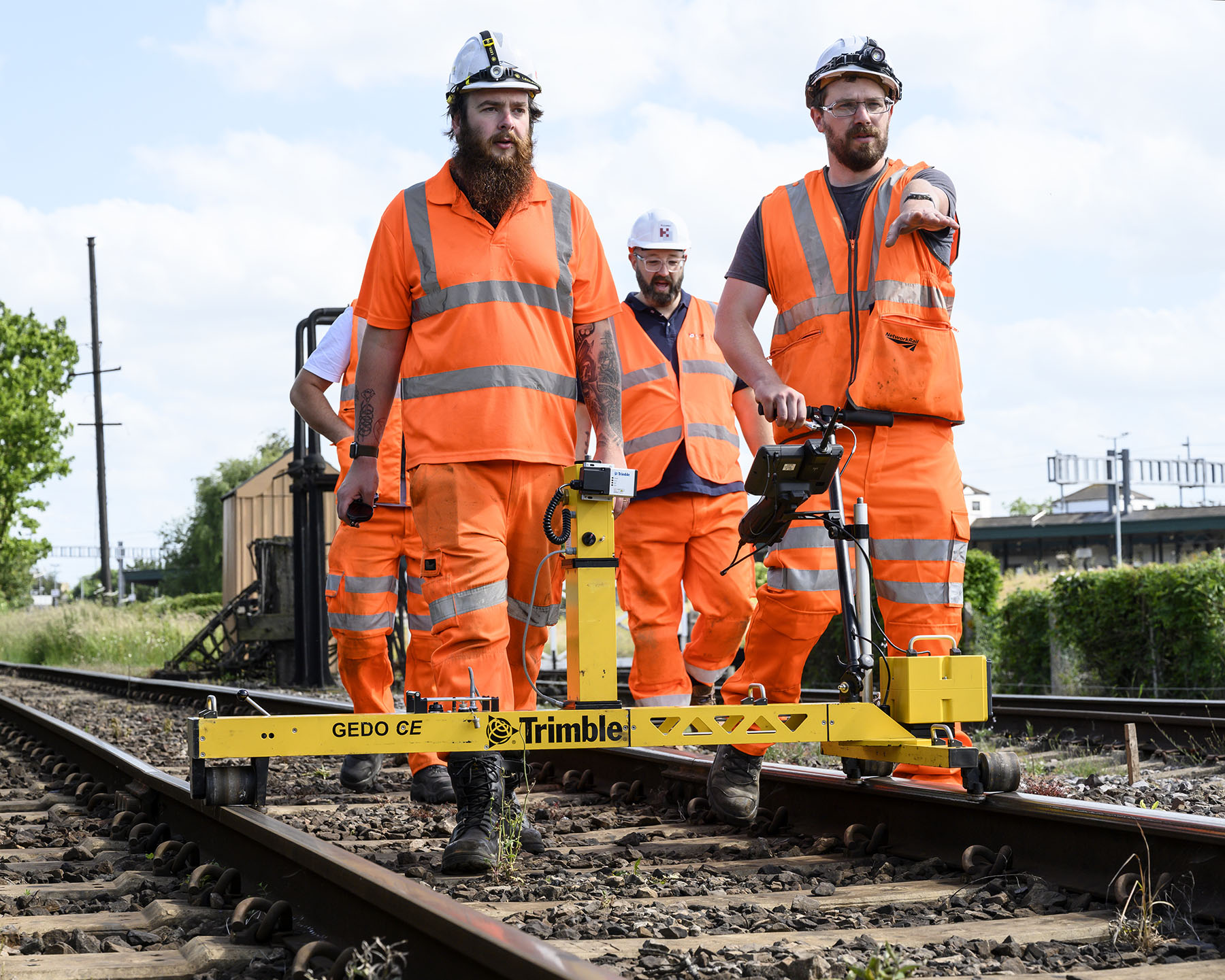
Although there will always be a place for traditional survey skills, technology has again absolutely transformed the survey world when it comes to rail or rail adjacent projects. Being so specialised, the equipment is often very expensive but it enormously increases efficiency. As just one example, track survey times have been revolutionised by track trolleys. Surveyors can now use these to undertake track trolley surveys which reduce the time spent on the track, as well as increasing accuracy. With a laser scanner mounted on the trolley too, the amount of data that can be collated at the same time is maximised.
Technological advances like this have made mass data capture so quick and easy that a land surveyor with the right skills now has the means to hand of providing so much more than basic site measurements. With the correct management of this massive amount of data, a geospatial expert can make sense of it in order to optimise its usefulness to a client. Whether it’s an individual building, a warehousing complex or a vast logistics hub, a trained surveyor can now produce a digital map that is so accurate you can remotely pay ‘a visit’ to it to interrogate any part of the site from anywhere in the world.
To find out more about the value of geospatial and the range of surveying specialisms provided by TSA members, visit www.tsa-uk.org.uk.

